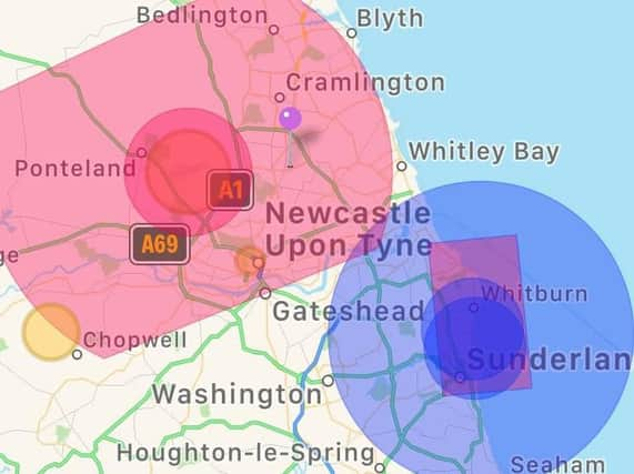
Police reveal airspace restrictions for drones ahead of Sunderland Airshow


Police have revealed which airspace restrictions are in place ahead of this weekend's Sunderland Airshow.
Northumbria Police is calling on those with drones to observe the "drone code" and have released a map showing where airspace is restricted over the next three days.
Northumbria Ops Support tweeted: "Additional Airspace restrictions in place due to @SunAirshow Abide by #dronecode
Advertisement
Hide AdAdvertisement
Hide Ad"More information available @NATS or download @NATS Drone Assist App @UK_CAA #flysafe #AirportPolice."
Hundreds of thousands of people are expected to visit Sunderland seafront to see a packed programme of flying displays, which run until Sunday.